


© 2021 www.dunmoreeast.net. All rights reserved Last updated 26 December 2021

The History of Gaultier

Dunmore East is a small fishing village on
the south-east coast of Ireland, 16kms from
the city of Waterford.
It sits on the western side of the Waterford
Harbour Estuary, 4.8kms from Hook Head in
Wexford.
Dunmore East, Co. Waterford,
Ireland
Patrick Power was born at Callaghane, three miles from Waterford, on 8th March, 1862. He was educated at
Ballygunner National School, the Catholic University School, Waterford, and St. John's College, Waterford. He was
ordained in 1883 and for three years he worked on temporary mission in Liverpool. Being threatened with tuberculosis,
he went to Australia, where he spent seven years in the diocese of Wilcania-Forbes, being Rector successively of
Cobar, Bourke and Wilcania, New South Wales. He came into contact with the aborigines; and it as probably in
Australia that his interest in archaeology was first developed. On his return to Waterford he was attached to the
Cathedral for three years; he then successively became Diocesan Inspector of Schools, Chaplain to the De la Salle
Training College, and Curate at Portlaw. About 1900 he published a Manual of Religious Instruction, which ran to thirty
editions and was used extensively in this country during the first two decades of the century; it appears to be still in use
in Australia. His interest in place-names, ecclesiastical antiquities and archaeology soon became more than a paragon
or hobby. He made extensive explorations throughout Waterford. Even in his student days he published in local papers
articles on Waterford history. For many years he was editor of the Journal of the Waterford and South-East Ireland
archaeological Society. In addition to numerous articles he published the following books:-
Celtic Crosses of Kilkiernan, Kilklispeen and Killamery (N.D.)
Chapel of St. Finbarr, University College, (N.D.)
The “Rian Bó Phádraig” (1903)
Place Names of the Decies (1907)
Donnchadh Rua Mac Namara (1911)
Dunbrody Abbey (1911)
Parochial History of Waterford (1912)
Lives of Saints Declan and Mochuda (1913)
Place Names and Antiquities of South East Cork (1917-18)
Ardmore Deugláin (1919)
Prehistoric Ireland (1922)
Early Christian Ireland (1925)
Ancient Topography of Fermoy (1931)
Ardmore: Its founder and Early Christian Memorials (1931)
A Bishop of the Penal Times (1932)
The Ogham Stones, University College, Cork (1932)
Short History of County Waterford (1933)
Aran of the Saints (1935)
Waterford and Lismore: A Compendious History of the United Dioceses (1937)
The Cathedral Parish of Holy Trinity, Waterford (1940)
St. John's and Ballygunner (1942)
From 1910 to 1931 he gave lectures on Archaeology in Maynooth. He became associated with University College, Cork,
and in 1915 he succeeded Sir Bertram Windle as Professor of Archaeology a post which he held until his retirement in
1932. In 1926 the National University of Ireland awarded him the degree of D.Litt. From personal experience I can
certify that Canon Power was a most agreeable colleague, with old-world courtesy and unfailing gentleness. He was
most unworldly, devoting all of his scanty means to the purchase of books and manuscripts. Barring his interest in
horticulture, he was devoted solely to his subject, retaining his studious habits even to the last. At the same time one
never forgot that he was a saintly priest, firm but unostentatious in his faith. Visiting him in the summer of 1950, an old
friend found him seated in a secluded corner of his garden, his long rosary trailing through his fingers. The Canon
brought him into his book-filled sitting-room and pointed to a pile of manuscripts on the table. “There,” he said, “is the
new edition of the Place Names of the Decies. It has cost me my eyesight; I am no longer able to read. I am handing
the material to Liam Ó Míodhacháin of Ring for final revision.” So the present book is the last work of this old scholar of
eighty-nine. He died on 16th October, 1951. The publication of this edition has been made possible by the financial aid
contributed by friends and admirers. 4th November, 1952. Alfred O’Rahilly University College Cork.
BARONY OF GAULTIER
GAULTIER (Gaill-Tír - “Dane Country” or “Foreigners’ land”) was so called from its occupation by a non-Celtic
population. The term Gall was, at one period of our history, synonymous with “Dane” or “Norwegian” and at another with
“Englishman.” In modern usage the word is largely restricted to the latter sense, while “Lochlannach” is applied to the
Dane of history. It is wonderful, by the way, how little the Dane has left his impress on the land names of the Barony he
made his own. Gaultier, as a local denomination, dates approximately from the expulsion of the Ostmen of Waterford
from the city on the arrival of the English. The first care of the new-comers was to hang Reginald, ruler of Waterford, for
having placed iron chains across the river to bar the progress of the invading fleet, and their second - to drive out the
Danish inhabitants, one Gerald McGilmore alone excepted. A particular district outside the walls was assigned the
dispossessed citizens - whence the “Cantred of the Danes” of later times, and the “Osmanstown of Waterford” (Plea-roll
of Edward 11. 1384).
Ballygunner Parish
The parish takes its name from Ballygunner townland on which the Church (now in ruins) stood. This church, it is evident
from TheinerTP87PT, was originally dedicated to a St. Mochorog, Confessor, whom we may safely regard as its founder.
Mochorog, like many of the early church founders of our eastern and south- eastern seaboard, appears to have been a
Briton, and son of Branchan, a British prince. At any rate such was the reputed nationality and parentage of the Saint
Mochorog who is honoured at Delgany, Co. WicklowTP88PT. This Mochorog of Delgany is stated to have assisted St.
Kevin when the latter lay dying. In post-invasion times a change of patrons was somehow effected in our Church, for the
survival of the ancient “pattern” on September 8PthP is proof that at the Reformation period the Blessed Virgin was
titular. For description of the ruined church and its graveyard see Journal of R.S.A.I., Vol. I., 5th Series, p.481. In the
Down Survey Map the parish is named Ballygunner Temple and the church appears to have been in repair at the date
of the survey. Amongst the crops grown in the parish in 1846 are mentioned peas, beans, and flax.TP89PT
TOWNLANDS
BALLYGUNNER - Baile Mhic Gonair (in three parts: - “B. Mór,” “B. an Chaisleáin,” “B. an Teampaill” respectively) -
“Town (or Homestead) of Gonar’s Son.” It is probably Dun Fan Connrath, in Waterford vicinity referred to by Dr. Todd
(“Wars of the Gaedhil”, Introduction p.cxxxix). Crowning a pleasant eminence on the townland of Ballygunnermore are
the (now) scant remains of a large lios which had souterrains within the thickness of its earthen ramparts. This is one of
our few land names which commemorate Danish occupation. There are on the townland one, now practically
demolished, circular lios of large size (O.M.) with a stone-lined subterranean chamber and one small, partly ruined
cromlech (O.M.). Ballygunnertemple is returned in the Down Survey as the property of Lord Power, and the other two
divisions of the townland as belonging to Sir Robert Walsh, Irish Papist. The Cromwellians liked good measure; they
reckoned the total area of the three divisions (including seven acres of glebe on Ballygunner Castle) at 649 acres. This,
as a matter of fact, was little more than half the real acreage. “James Walshe (father, or grandfather, presumably, of the
Sir Robert Walsh of Petty’s Survey) of Gonnestown” appears as a juror in an Inquisition of ElizabethTP90PT. The castle
(modernised) of the Walshes is still in use as a residence. A Fair of Ballygunner was held on Sept. 19PthP. Area (in
three divisions), 1212 acres. S.DD. (a) Currach Gorm - “Blue Bog (or Marsh),” a small subdivision; the name is
Anglicised - “Foxy Bog.” (b) Baile na Gaoithe - “Homestead of the Wind,” from its exposed position; a well-known sub-
division, regarded locally as practically a separate townland. (c) Cill Bhriocáin - “Brican’s Church”; site (nearly forgotten)
of a primitive church on Baile na Gaoithe. There are no remains, but the exact spot has been identified, scil: -
immediately to N.E. of surveyor’s mark 163, on Ordnance Sheet (six-inch) No. 18. (d) Aoileachán - Meaning uncertain;
probably derivative from Aol, lime; a large sub- division formerly well known by this name. (e) An Sléibhín - “The Little
Mountain.” a sub-division of 25 acres. TP87PT “Vet. Monurnenta” - Pius II., A.D. 1459. TP88PT Journal of the Royal
Society of, Antiquaries of Ireland, June, 1901, page 186. TP89PT Ordn. Survey Field Book. TP90PT Inquis. IX., Eliz.
(1567). (f) Carraigín Gheal - “Little White Rock,” on B. Castle. (g) Bóithrín na gCorp - “Little Road of the Corpses”; a
former road which led N. from the old Church on Ballygunner Temple.
BALLYMACLODE, Baile Mhic Leod - “McLeod’s Homestead.” On the townland is a comparatively late castle in ruin.
This was probably the homestead of the settler from whom the place derives its name. Ballymaclode, like Ballygunner
Temple, was in the possession of Lord Power at the date of the Cromwellian confiscation. Area, 374 acres. “Bally
McClode” (A.S.E.); “Ballemaclode” (Inquisition, temp. Eliz.) S.D. Glennacruther (0.M.), Gleann an Chruitire - “The
Harper’s Glen.” Of the ancient master of Irish melody no history or tradition whatever survives. CALLAGHAN,
Ceallachán - Meaning doubtful; apparently “Little Place Belonging to a Church”; or perhaps (and less probably) the
name is an Irish diminutive of the old English word callow - therefore “Little Wet Place.” “Callow” is still commonly used
in the Leix County to denote wettish land which is often submerged in winter and grows long coarse grass in summer.
The present townland contains a large area of bog and was mainly noted a century ago for its output of peat, hence the
epithet - (Ceallachán na Luaithe Bhuí). O’Donovan statesTP91PT that the place-name here is the personal name
Callaghan. ElsewhereTP92PT he notes that in Co. Roscommon the word Caladh designates a meadow, strath, or holm
by the margin of a river; the first syllable, however, in the present instance, is pronounced slender - i.e., Ceall.
Callahane was in the possession of John Lee, Irish Papist, previous to Cromwell’s confiscation, and the Patent and
Close Rolls of Chancery enable us to trace portion of its previous historyTP93PT. The authority quoted recites the
following alienations of the lands previous to that date. (1) James Power of Callaghane to Patrick Coppinger and
Richard Meaghe (Meade). (2) Said Coppinger and Meaghe and William, son of afore- mentioned James Power, to
William Dobbyn, his heirs, &c. (3) Said William Dobbyn and William Power to John (son of James) Sherlock and William
Walsh. Area, 447 acres. S.DD. (a) Báintín an Chaptaen - A field name. (b) Cúinne an Ghabha - “The Smith’s Angle.”
“Callahane,” (Down Survey). KNOCKBOY, Cnoc Buí, “Yellow Hill,” from the colour of the blossoming furze. The furze
has disappeared long since, and well-tilled fields occupy its place, Area, 228 acres. S.D. Tobernacnockaun (O.M.),
Tobar an Chnocáin, “Well of the Little Hill,” near N.E, extremity of the townland.
Ballynakill Parish
The ancient church of the parish stood about 60 yards to the S, by E. of the present Ballinakill House. Some insignificant
remains of the church are visible in the stable yard of the house in question, and part of the ancient cemetery, in which a
few families retain rights of burial, is surrounded by an enclosing wall. A considerable portion of the church building
survived till about a hundred and fifty years since.
TOWNLANDS
BALLYNAKILL, Baile na Cille - “Homestead of the Church.” Area, 358 acres. “BallemcKill” (Visitation Book, T.C.D., E. 3.
14). S.DD. (a) “Weaver’s Lane” - abutting on Waterford-Dunmore road at W. End of Power’s Nursery; the name is now
almost forgotten. (b) “Ceathrú an Mhuilinn” - “Mill Quarter,” extending to some twenty or thirty acres. (c) An Tuairín - “The
Little Bawn,” a field close to the river. Tuar and its diminutive, as in present case, are of very frequent occurrence in
place- names throughout Waterford. They occur most frequently in mountain districts. Dictionaries render the word by
“bleach green,” but this explanation is evidently incorrect, or rather, insufficient. The existence of bleach greens in
mountains where nobody lives, or ever did live, cannot be admitted. Unfortunately for us, the word has fallen out of use
in Waterford otherwise than as a component of place names. O’Donovan in at least one instanceTP94PT explains it “a
green grassy patch on a mountain side” such as presence of a spring would produce, and this or some such meaning
the word must have in many instances. In the adjoining County of Cork, as well as in other Munster counties, the word
Tuar is in frequent use to denote a well-fenced night field or “bawn” for cattle. (d) “The Red Ladder,” a rock by the river
side from which an iron ladder formerly led down to the water. TP91PT Ordnance Survey Field Books (Co. Waterford),
Mountjoy Barracks. TP92PT Annals of the Four Masters, Vol. 111., p.214 (note). TP93PT Membrane 28PthP 4. Chas. I.
(1628). TP94PT Field Books, OS. “King’s Pond,” a broad, but shallow, pool by the roadside ; called from the family on
whose holding it was. “Flynnvilla,” the now obsolete name of what became the Kings homestead later.
FARRANSHONEEN, Fearann Sheoinín - “Little John’s (or Jennings’) Land.” Area, 174 acres. GRANTSTOWN, Baile an
Ghrantaigh - “Grant’s Homestead.” The Grants were an old Waterford Anglo- Irish merchant family (originally Kilkenny)
whose tomb (17PthP century) may still be seen in the French Church. When the article is used before a proper name
the latter is taken adjectively; in the present instance therefore the sense is - Homestead belonging to member of the
tribe, or family, of Grant. Area, 276 acres. S.DD. (a) Bán Dhráide - “Drawdy’s Field”; a sub-division of some fifteen
acres. The personal name from which this sub-division is called is now extinct in Waterford. (b) Bán an Bharcair,
“Barker’s Field.” The Barkers were a well-known Waterford family of Cromwellian origin. Their name is likewise
perpetuated in Barker Street, Waterford, which occupies place of the gardens of an early 17PthP century Alderman,
Samuel Barker. LITTLE ISLAND, An tOileán Beag, “The Small Island.” The island occupies the middle of the river a
couple of miles below the City of Waterford, and is identical, according to Rev. Dr. KellyTP95PT, with Inisdomhle of the
Martyrologists where St. Bairrfhinn, son of Aedh, Prince of Dublin, founded and governed a religious house. It may,
however, be laid down as practically certain that the learned hagiologist is incorrect in his identification. No trace or
tradition of church, monastery or burial ground has been brought to light by a most careful examination of the island.
Had a religious establishment of the kind attributed ever tradition of it could not have entirely died out. “Martyrology of
Donegal” expressly places Inisdomhle Cinnsealaigh (Co. Wexford). The adjective was added our island from the “Great
Island” lower down the graphically the “Little Island” would seem to belong rather than to the Decies, as the channel
separating northern mainland was formerly fordable. The ford exists for the channel has been deeply dredged. On the
island century castle of the Walshes’ which has been metamorphosed into a beautiful modern residence. Edward I.
(1284) delivered the Little Island that belonged to Robert le Poher “Walter Bp. of Meath.” Dr. O’Foley calls my attention
to Vol. 11. of Deeds, pp.59, 60, etc., to Ile Malure, Insula de Malure, etc. - the Island on the Suir, near Waterford, under
1359, and Two following years. Malure which also appears as Malour looks like a personal name and may be Danish.
On the other hand, it suggests Mo Loghoir, the name of a saint who is honoured in the Gorman, under May 11PthP. Or
may it not be the Anglo- Norman name Miler, or Maylor, still represented in the vicinity? Area, 287 acres. S.DD. (a) “The
Ford,” the river channel between and Co. Kilkenny. (b) “King’s Channel,” the deep water channel island from the Co.
Waterford mainland. (c) “Piper’s Rock,” in river on north side of the island. (d) “Golden Rock,” in river on south side of
“Golden” is here most likely a corrupt Anglicisation a shoulder. KILCOHAN, Cill Chuacháin - “Cuachan’s Church.” With
much difficulty the site of the ancient church was discovered, at the west side of the old Tramore road, close to the
bridge on boundary of the townland. Cuachan is the diminutive (or rather the endearment form) of Cuach, name of a
virgin, whose feast falls on Jan. 8PthP. She is the patroness of Kilcock, Co. Kildare. Area, 228 acres. S.D. “Yellow Ford
Bridge” (Ord. Map) - Cabhaisín Buí - “Little Yellow Ford.” There were several words for a ford. The most common are
cabhar and Áth. Cabhaisín - perhaps from the English, causeway - seems to have implied some sort of raised path
across the stream, while Áth was a more generic term. The cabhar was generally furnished with stepping-stones often
of very large size. WILLIAMSTOWN, Baile Uilliam- “William’s Homestead.” Area, 549 acres. S.DD.- Carraig an Bhuidéil
- “Bottle Rock” - (perhaps from its shape); a rock outcrop now partly quarried away for road metal. (b) Poll na Bríce -
“Brick Hollow” ; a few small fields in which, judging from the name, bricks were once made; no memory however, or
even tradition, of the industry survives. (c) “Bottomy” -the (presumably) modern name applied contemptuously to a few
worthless fields, cultivation of which was sarcastically equated with penal servitude in “Botany” Bay. (d) “Deer Park,” two
fields to which the name is occasionally applied. (e) Currach na gCapall, “Wet Place (marsh) of the Horses.”
Corbally Parish
This parish contains only two townlands (one of them in two parts). Indeed it is only in a modified sense that it can be
considered a parish at all - in the sense, namely, that it furnished name and revenue to a prebend, or canonry, in the
Chapter of Waterford. The parish has no proper church, and was doubtless of comparatively late formation. TP95PT
“Calendar of Irish Saints.” p.94.
TOWNLANDS
CORBALLY, Corr an Bhaile - “Point (Peak) of the Homestead.” The townland is sub-divided into two nearly equal parts -
C. more and C. beg. Total area, 508 acres. S.DD. (a) Garraí an Chamáin - “Garden of the Hurley,” from its shape. (b)
Bán na Sráide - “Field of the Street.” “Street” is used in the sense of “village.” The name is of frequent occurrence in
places where, as in the present instance, there is now not a house, or sign of one, remaining. Hundreds of these
“streets” disappeared in black ‘47 and subsequent years. (c) Carrickadun (Ord. Map), Carraig an Dúin - “Rock of the
Dun.” Dun is primarily a fort, but in the present instance, as in scores of similar cases in Co. Waterford, the word is
applied, in a secondary sense, to rounded dome-like hills of no great elevation, such as would be chosen by a primitive
people for fortification or residence. (d) Sean Mhuileann - “Old Mill,” at western extremity of the townland. (e) Gleann
Mionnáin - Apparently, “Kid’s Glen” ; more likely, “Glen of the Jacksnipe.” (f) Gleann an Dodaigh - “Dodd’s Glen,”
forming boundary between this townland and Kilmacleauge East. (g) An Sprid (Spiorad)- “The Spirit”; a field frequented
by a ghost and regarded with popular and appropriate dread. (h) Bóithrín an Sweep. (i) An Cnoc, a sub-division.
O’Donovan makes it Cúl Lom - “Bare Ridge” (Headland). The greater portion of this townland is in Rathmoylan parish.
Area of the Corbally portion, 155 acres. “Cooleham als Coolum” (A.S. & E.). Cootum. O’Donovan makes it Cúl Lom -
“Bare Ridge.” (Headland). S.D.D. (a) Cloonliamgowl (Ord. Map), Cuan ’ Liam Gallda - “Harbour of William the
Foreigner.” The foreigner, according to local belief is William of Orange, some of whose followers are represented as
having landed here! Near low water mark are some foundations of what would appear to have been a stone built pier.
The headland enclosing the little haven on the east was defended on the land side by a double earthen wall, of pre-
historic character, thrown across its neck. The entrenchment seems to have been strengthened in its interior by stone, a
large quantity of which a neighbouring farmer extracted from it. Portions of the ruinous wall still rise to the height of
nearly eighteen feet. Between the wall and the sea lies half an acre of level saxifrage-covered sward, the former
encampment of an ancient colony. Formerly no doubt the space enclosed was much larger ; the encroachment of the
ocean along this coast is very marked and the yearly tribute of the cliffs to the Atlantic very considerable. The fortified
headland is known as “Oileán ’ Liam Gallda.” (b) Uaimh an Chasáin - “Cave of the Pathway.” (c) “Palm Oil Hole,” so
called from wreck here of a ship laden with the commodity named. (d) “Flour Hole,” where a flour laden vessel met her
doom. (e) Benlea Head (Ord. Map) ; Beann Liath - “Grey Headland”; the official name is tautological.
Crooke Parish
The church was impropriate in the adjoining Preceptory of Knights Templars. Of the latter only an insignificant portion of
a strong castle survives. Beside this is a well sacred to St. John Baptist, to whom the church also appears to have been
dedicated. The church ruin has in its east gable a triple-light window of early English character, so that in all probability
the building dates from the earliest post-invasion period. For a fuller account of the church, &c., see Journal of the
R.S.A.I., Vol. I., Series 5.
TOWNLANDS
BALLYDAVID, Baile Dháithí - “David’s Homestead.” Area, 227 acres. S.D. Lisaniska (O.M.), Lios an Uisce - “Water Lios.”
CARRICKSAGGART, Carraig Sagairt - “Priest’s Rock.” Area, 234 acres. S.DD. (a) Carraig Fiaigh - “Hunting Rock.” (b)
Carraig an Ghabha -“Smith’s Rock.” (c) Bearna Cróine - “Gap of the Dun Coloured Place”; meeting place of four
townlands. COOLTEGAN, Cúl Taidhgín - “Little Tiege’s (or Tagan’s) Ridge.” A subterranean passage was discovered
here a hundred years since, but was subsequently closed. Area, 118 acres. “Cooletegin als Cooletegan alias
Cooltegine” (A.S.E.). CROOKE, An Chruac - “Crook” is old Scandinavian for a bend as wick is for a bay. (“A Survey of
English Place Names,” Mawer & Stanton, p.59). Area, 425 acres. S.DD. (a) Glebe (O.M.). (b) Passage (An Phasáiste)
Hill (O.M.); ruined windmill on summit. (c) Carrickcannuigh (or) Carraig an Cheannaithe - “Rock of the Purchase.” (d)
Spy Hill (O.M.), Carraig an Radhairc - “Rock of the View.” (e) Bóithrín an Trá - “Little Road of (to) the Strand.”
DROMINA, Drom Eidhne - “Ivy Ridge.” Area, 373 acres. “Druminagh” (D.S. Map); “Dromenagh” (S.S.E.) S.DD. (a)
Carraig an Bharraigh - “Barry’s Rock,” forming northern terminus of Woodstown Strand. (b) “The Pollock Rock.” to east
of last and below high water mark. (c) Ráth an Leacht - “Rath of the Grave Monument (Stone Pile).” This is nowadays
more commonly known as the “Giant’s Grave.” (d) Móinéar na gCeann - “Meadow of the Heads,” close to the last. The
name is applied to two fields in which were found, over a century since, a number of human skulls, broken swords, &c.
(e) Prehistoric shell-mound. KNOCKPARSON, Cnoc Phearsuin - “Parson’s (personal name) Hill” Area, 88 acres.
NEWTOWN, Baile Nua. Idem. Area, 272 acres. “Newtowne” -(A.S.E.). S.DD. (a) New Geneva (O.M.), a space of about
twelve acres enclosed by a high stone wall with flanking towers at the angles. This was originally the site of a colony of
Genevese, founded about 1785. The Irish Parliament voted £10,000 in aid of the settlement. In consequence, however,
of the demand by the colonists of certain privileges which it was not thought proper to concede the settlement was
abandoned. Next year the Government commenced the erection of the barracks, of which some remains survive. These
afforded accommodation for 1,500 men, and were occupied by militia and troops of the line. “Geneva Barracks”
acquired notoriety in connection with the Rebellion a few years later. Many are the stories still current, or current half a
century since, amongst the country people, of the dark deeds done within these frowning walls. “New Geneva” came to
an inglorious end in 1824, when it was purchased by the Marquis of Waterford, who sold the buildings to a Mr. Galway
(merchant) of Dungarvan, by whom the barracks were dismantled and much of the material carried by water to
Dungarvan. (b) “The Review Ground,” a space of nineteen acres (Irish). RAHEEN, Ráithín - “Little Rath.” Area, 200
acres. “Rahine” (A.S.E.). S.DD. (a) Sean Shráid - “Old Village.” (b) Macha na mBó - “Milking Place of the Cows.”
Faithlegg Parish
In the Down Survey mapTP96PT this is represented by a single townland which gives name to the parish. The two
additional townlands therefore must have been formed out of the first within the past 250 years. It is remarkable that in
the whole parish there was not, half a century since, a single native Irish speaker - a fact very regrettable from the point
of view of the place-name student. The ruins of the ancient church are in an excellent state of preservation ; they
consist of nave and chancel connected by a pointed chancel arch of wrought red sandstone. The west doorway, also of
red sandstone, and in harmony (architecturally) with the chancel arch is somewhat elaborately molded. Within the nave
is a rather remarkable holy water stoup or baptismal font which has been deemed worthy of notice and illustration by
Brash. For further notice of this church see Journal R.S.A.I., Vol. I., Series 5, p.481.
TOWNLANDS
CHEEKPOINT, Pointe na Síge - “Point of the Streak.” Thanks to the ignorance of guide book compilers the name is
popularly supposed to imply fairy occupation or connection (Síghe - a fairy). Síge however (not Síghe) is the word
entering into composition, and the origin of the name seems clear enough, scil:- from a rock, Carraig na Síge - out in
the river near low water mark. A strong and rapid current sweeps over the jagged sides and summit of the rock, and the
consequence is a long trail, or streak, of foam down stream with the ebbing tide and up the river with the flow. Also
called Rinn na Síge. Area, 199 acres. S.DD. (a) Carraig na Síge - “Rock of the Streak”, as above. (b) “The Russian
Side,” portion of Cheekpoint so called because, according to local story a Russian family or small colony once
established itself there. (c) Braonóg - “Little Drop”; a well. (d) An Móta - “The Mote.” (e) Garraithe Arda - “High
Gardens”; a sub-division. TP96PT Record Office, Dublin. COOLBUNNIA, Cúl Buinne - “Ridge Back of the Stream.”
Close to the ruins of Faithlegg Church in this townland is a mote with the ruined castle of the Aylwards within its bailey.
The castle stood a short siege in 1649, when it was defended by its owner against a Cromwellian division. The
Protector, who, it appears, had known Aylward previously in England, offered what he was pleased to call favourable
terms. Acceptance was however incompatible with the religious tenets of the besieged. Under the circumstances the
garrison refused to capitulate, and the proprietor with his faithful retainers diedTP97PT, like Horatius facing fearful odds
for his faith and his ancestral acres. Such is the account popularly given and believed and in part (at any rate)
substantiated by documents.
FAITHLEGG, Féidhlinn. The name, which possibly is not Irish, has long been a puzzle, which we can only hope future
investigation may solve. Unfortunately the oldest forms of the name afford no help towards a solution. An Inquisition,
temp. Elizabeth, renders the name - Faithlegg als Faithlack ; the Acts of Settlement and Explanation, which make it -
Faithlegg als Faithlegg, are equally powerless to help. If conjecture be admissible for once, I would suggest Féileann,
gen. Féilinn, “Woodbine”TP98PT as the term. This would suppose the name to be in the genitive, a phenomenon easily
explicable from the present local name of Faithlegg Hill, scil:- Meannán Fhéilinn. The modern Irish for woodbine is
Féathlóg, a term which would explain the old form of the name - “Fathlock.” It is well to recollect that old Anglicised
forms of Irish names not only represent the sound but very often form a picture of the name as it appeared in Irish
spelling. Area, 353 acres. “Faithbeg” (D.S.M.); ffylyn (Indenture, 1508.-See Journal W. & S.E.I. Archaeological Society-
April, 1906). S.DD. (a) “Knockrotton” - Cnoc an Ropadh - “Rock of the Tearing” or “Rushing” This was a demesne of 21
acres in which stood the country residence of John Roberts, the architect, great grandfather of Lord Roberts, and
builder of the Catholic and Protestant Cathedrals of Waterford. (b) “Bolton’s Rock,” on the river bank. (c) Tobar
Sionnaigh - “Well of the Fox,” though it is possible the latter member of the name is personal. This well, which is nearly
opposite the church and on the west side of the road, had the reputation of sanctity. “Rounds” or “stations” were made
here, but have been discontinued for nearly a century. (d) Tobar an Chait - “The Cat’s Well.” The cat figures frequently
in place names in Waterford. How his feline highness come to be associated with a well it is not easy to conjecture. (e)
“St. Lawrence’s Well.” O’Donovan found this well on north-east side of the townland.TP99PT (f) Meannán Fhéilinn -
“Crown-shaped Hill of Faithlegg.” This is the well- known Faithlegg Hill, the most prominent physical feature of the
Barony. From the summit a view of singular historic interest and of great beauty is afforded. Its coat of heather lent the
hill a rounded (smooth) outline. KILCULLEN, Cill Chuilinn - most probably “Cullen’s Church,” though the name is locally
pronounced as if it meant “Church of [the] Holly.” There is a St. Cuiileann honoured on April 22PndP in the Irish
martyrologies, and a St. Cuillenn on Nov. 5PthP.TP100PT What is possibly the early church site may be seen-an
untilled and bramble- overgrown patch, in a field by the roadside, a few perches north- east of Delahunty’s avenue gate.
The old mail road to Cheekpoint ran close by the west side of the supposed cill, whence it was diverted to its present
course.
Kilbarry Parish
The name of the parish is ecclesiastical in its origin, incorporating the ancient church founder's name (Barra). The
church, to which there are some references in municipal documents and monastic charters, passed early into the hands
of the Knights Templars, who erected a Preceptory of their order beside it. Though close to the Danish stronghold the
original formation of the church was Celtic, as the name, retained through all the ages, indicates. Only insignificant
remains of the church survive, and the cemetery had, a few years since, become so crowded that the Sanitary Authority
was obliged to close it to further burials.
TOWNLANDS
BALLINAMONA, Baile na Móna - “Homestead of the Turf Bog.” There is little trace of turf cow, and the bog (on the east
side of the townland) which gave the place its name, has been drained long since. Area, 348 acres. S.D. Carraigín na
bhFiach - “Little Rock of the Ravens.” This is a sub-division and a name, almost as well known as the townland and the
townland name themselves. TP97PT Cromwell in Ireland, Rev. D. Murphy, S. J. TP98PT Hogan “Gaelic Plant Names,”
p. 122. TP99PT Field Books (Waterford), Ordnance Office. TP100PT Martyrology of Donegal, at dates specified.
BALLINDUD, Baile an Dodaigh - “Dodd’s Homestead”.TP101PT Area, 400 acres. S.DD. (a) “Sheep’s Bridge” (O.M.).
Modern though this name looks it can boast of very respectable antiquity ; it occurs (in the form “Shepyn Bridge”) in a
lease dated Oct. 1495, from John Devereux, Benedictine Superior of St. John’s, Waterford (to which house “Shepyn
Bridge” belonged), to Thomas Shallway, of the City of Waterford. Three hundred years earlier our bridge was ancient
enough to be known as “The Old Bridge.”TP102PT The Crompan stream flowing down from Tourgar is still generally
resorted to, especially at Sheep’s Bridge, for sheep washing. (b) “Cromlech,” a fine dolmen, though somewhat ruined
owing to failure of one of its supports and consequent tilting of the table stone. (c) Cillín - “Little Burial Ground.” The
word Cill from the Latin cella was used to designate a primitive church. When the church disappeared the word came to
signify the graveyard, and in this latter sense cill is generally used now. To add to the confusion cill, and still more, cillín,
is applied to pagan as well as Christian places of sepulture. The cill, or cillín, site at Ballindud is close by the roadside, a
few perches south-west of the main entrance lodge to Ballinamona Park; it is not marked by monument or remains of
any kind, and some difficulty was experienced in locating it. BALLYBEG, Baile Bocht - “Poor Town.” The real name was
changed about a century since, to Baile Beag (“Small Town”) for reasons other than euphonic. Area, 267 acres.
BALLYHOO, Baile Húgh - “Hugh’s Homestead”; perhaps Baile Thuaidh. Area, 300 acres. BALLYNANEASHAGH, Baile
na nDéiseach - “Town of the Decies (family)”. Dr. O’Donovan suggests that a family of the Decies race may have lived
here, amongst strangers, in the Danish or Norman period.TP103PT Area, 333 acres. S.D. St. Ottern’s Cemetery -
enclosed in “Black ‘47” a place of burial for the poor and strangers. CARRIGANARD, Carraig an Aird - “Rock of the
Height.” This townland was formerly part of Ballybeg (Ballybocht). Area, 163 acres. S.D. Sean Shráid - “Old Street” ; the
site of a former village. CARRIGROE, Carraig Cheoch - “Misty Rock.” O’Donovan appears to be responsible for king, if
not for inventing, the name Carraig Rua - “Red Rock.” It is not easy to understand how the error originated. Perhaps -
but this is almost incredible - the great topographer mistook the adjective. The latter is certainly ceoch, not rua. We
have here an instance of affected and irregular Anglicisation due largely, perhaps, to inability to pronounce the gutturals
of the qualifying word. Area, 93 acres. S.D. Sráidín - “Little Street”; site of a village. COOLGOWER, Cúil Ghabhar -
“Goats’ Ridge-back.” It was into the Goolgower bog-hole, or pond, that the head of Crotty, the outlaw, was finally cast
some time subsequent to his execution in Waterford (1741- 2). Area, 93 acres. KILBARRY, Cill Bharra - “Barry’s (or
Bearach’s) Church”; so called, no doubt, from the founder. Area, 456 acres, of which nearly a third is marsh. S.DD. (a)
Sean Mhacha - “Old Milking Place” ; a field. (b) Bán na hAidhle - “Field of the Adze?”; the name of yet another field. The
word Aidhle or Aibhle occurs at least three times in place names of the county. It has various meanings - an adze, a
breeze, a spark, &c. (c) Baile na Siotrach -“Homestead of the Neighing (of horses).” It indicates site of a farmstead
where stud horses were at one time kept. LACKEN, Leacain (Locative case) - “Glen Side.” Leaca is primarily - a cheek,
whence the secondary meaning - a hill, or glen, side. The word occurs with great frequency in place names - nearly
always however in composition. From an Inquisition quoted below it appears that sixteen messuages in this townland
belonged to the Priory of St. John at Waterford. Area, 147 acres. “Lackyn” (Inquis. temp., Chas. I.); “Le Leccan” (Inq. at
Passage June 12th, 1536). S.D. Carraigín na hEornan - “Little Rock (by extension ‘Little Rocky Place’) of the Barley.”
Kilcaragh Parish
This parish consisted originally of only a single townland. Later, a sub-division of the latter became an independent
townland under the name of Bishopscourt. The parish was a prebend or canonry in the Diocese of Waterford and
formed portion of the endowment of the Deanery. TP101PT Comp. Gleannadodaigh, under Corbally, above. TP102PT
Charter of St. John’s Priory, Waterford - see Journal, Waterford and S.E. Ireland Archaeological Society, Vol. 11.. pp.83,
&c. TP103PT Field Books, as above, Ordnance Office, Dublin.
TOWNLANDS
BISHOP’S COURT, Cúirt an Easpaig. Idem. This townland, originally part of Kilcaragh, existed as a separate
denomination as early at least as the middle of the 17PthP century. It derived its name from a castle or Mansion -
(vestiges of which survive) - the summer, or country, residence of the Bishops of Waterford. The castle farm continued in
the personal occupation of the Protestant Bishop till the Disestablishment. Area, 3 18 acres. KILCARAGH, Cill
Chathrach - “Church with Stone Rampart.” The early Irish ecclesiastical establishment was surrounded by a circular
fence of earth or stone, and most of our early church enclosures - those at least on which later churches have not been
erected - still preserve this circular form. Cahirs are comparatively rare in Waterford. In fact only a specimen or two
survive, but the occurrence of the word in place names proves that stone forts were formerly far from rare. The
comparative scarcity of stone accounts for the enormous preponderance of earthen forts in this county. In the present
instance all trace of church and cahir has disappeared, but a few old people, fifty years since, remembered portion of
the church ruin. It is probable there was no graveyard; this is deduced (1) from the absence of all tradition of its
existence, (2) the diminutive size of the parish, which can never have had more than a dozen people, and (3) the rocky
nature of the church site and surroundings, in which it would have been practically impossible to dig graves. Absence of
a cemetery accounts for the complete disappearance of the church ruin. O’Donovan, it is interesting to note, gives two
derivations of the place name. In the Ordnance Survey correspondenceTP104PT he makes it - “St. Carthage’s Church,”
while in the Field Books of the surveyTP105PT - as the result, doubtless, of more mature consideration - he renders it
“Church of the Stone Fort.” S.DD. (a) Knockanaurum, Cnoc an Eachdhroim - “Horseback Hill,” from its appearance at a
distance. Popularly and locally the last word of the name is believed to be Achrann and stories of an ancient battle have
been invented to dignify hill and name. Compare Aughrim Cos. Galway and Wicklow. (b) Bán an Phátrúin - “Field of the
Pattern.” It is hardly necessary to explain that “An Pátrúin” was a public celebration of the patronal feast of the church.
At first purely devotional, the celebration - owing mainly to the operation of the Penal Laws - became largely festive.
Consequent on the confiscation and ruin of the Church buildings, &c., the people were driven from the accustomed
places of assemblage. Gradually the religious element in the celebration diminished, and too often the “pattern”
degenerated into a scene of riot and drunkenness. This led in scores of instances to the suppression of the meeting by
the clergy but, in comparatively few instances, to its reformation. (c) Sean Leamhán - “Old Elm”; a field name. The Elm
rarely figures in place names. (d) Bán na Péiste - “Field of the Reptile (or Worm).”
Kilcop Parish
Though the site of an early church on its single townland, as well as its name, indicate the ancient ecclesiastical note of
the place, the present parish division seems to be comparatively modern. It appears as part of Crooke in the Down
Survey, and is not mentioned in the early Visitation Books. Not a vestige of the ancient church survives, and the first
Ordnance Surveyors failed to find even its site. One is inclined to conclude they did not search far. St. Coppa, virgin
(daughter of Baltain) is commemorated on January 18th in the Martyrology of Gorman. The ancient church site is close
to the entrance gate to Kilcop House - on the opposite side of the road.
TOWNLANDS
KILCOP, Cill Chopa - “Coppa’s Church.” Area, 387 acres. “Killcopp” (Inq. Jac. I.). “Kyllkippe”(Inq. Eliz.). S.DD. (a) Áth na
Muice - “Ford of the Pig”; - probably from some legendary pig, as suggested by use of the singular. (b) Cnocán na
nGabhar - “Little Hill of the Goats.” (c) Tobar an Droma - “Well of the Ridge.” (d) Bán an Teampaill - “Field of the
Church,” in which are traceable the exact site of the early church and the line of its circular fence scil : - almost opposite
the entrance gate to Kilcop House but separated from the gate entrance by the public road. TP104PT Library, Royal
Irish Academy. TP105PT Ordnance Office, Mountjoy Barracks. Killea Parish THIS parish takes its name from Aodh, a
disciple of St. Declan, who established a cell here in the latter’s lifetime, and whom St. Declan called to minister to him
when he found death approachingTP106PT. The English rededicated the church under the invocation of the Holy Cross
(Sept. 14PthP). All traces of the original church have disappeared, and of the 14PthP century church which succeeded
only portion of the tower and south wall surviveTP107PT. In 1203 is recorded a grant to Heverbrict of Dunnor of the
Church of St. Eoth (Killea) Culech (Contown) and Fornach (Sweetman’s Calendar).
TOWNLANDS
AUSKURRA, Áth Scurra - “Scuire’s (or Scurry’s) Ford.” Area (in two divisions), 48 acres. BALLYMABIN, Baile Mhaibín -
“Mabin’s Homestead.” Area, 291 acres. “Ballymabbin” (Inq. Car. I.); “Ballyvabeene” (Down Survey Reference). S.D.
Tobar na Baidhbe - “The Bibe’s Well.” The “Bibe” is a supernatural being of Beansí affinity to whom we have numerous
references in place names. She was battle goddess of the pagan Irish. COXTOWN, Coilleach - “Woody Place,”
according to O’Donovan. This derivation is strongly suspect. The name is locally understood to be coileach, a cock,
hence the Anglicised form, to account for which a curious story is told.TP108PT Area (in two divisions, scil - East and
West), 417 acres. S.DD. (along cliff line from east to west). (a) Uaimh Ráithe - “Cave of the Rath.” (b) “Aby’s Folly.” This
is a path down the cliff perpetuating the cane, &c., of its maker, a man named Abel. Judging by the name the utility of
Abel’s work was not generally recognised. (c) Uaimh na Scadán - “Cave of the Herrings.” (d) Port Srutháin - “Haven of
the Little Stream.” Port is very generally used in Waterford to designate an embankment by a river to prevent
inundation. Along the coast however, as in the present instance, it is a haven. (e) “Red Head” (O.M.); so called from the
decided hue of the old sandstone. This is almost certainly the “Ruddybank” of the invaders and of early charters. (f)
Uaimh an Ghaibhlín - “Cave of the Little Estuary.” (g) Pus na hUamha - “Lip of the Cave.” (h) “Bishop’s Cove”; the name
is modern-possibly from some man named Bishop who lost his life here. There is also “Bishop’s Cave,” a great and
steep pit of the puffing-hole class, some forty yards inland from the cliff's edge and fifty or sixty feet in depth. Bishop’s
Cave is now protected by a wall, but before the erection of this fence more than one life had been lost there. (i)
Oonarontia (O.M.), Uaimh na Rónta - “Cave of the Seals.” (j) Poll an Dorais - “Hole (or Pool) of the Door.” The word
door, in such contexts, occurs occasionally in cliff names; its exact force in this connection it is difficult to determine.
CREADAN, now Ceann Chníodáin, formerly Ceann Chríodáin - Meaning uncertain. Ceann is of course a headland, and
the qualifying word may be a personal name. Creadan Head is the place so often referred to in charters, annals, &c., as
the most easterly point of Co. Waterford. Area, 497 acres. “Credane” (A. S. & E.). “Ceann Crete” (“Wars of Gaedhil and
Gaill”). S.DD. (a) Clais Ruairí - “Rory’s Trench”; an indentation caused partly by a landslip on the cliff edge near the
central part of the townland. (b) Ardnamoult (O.M.), Ard na Molt - “High Place of the Wethers”; a headland less
prominent than that from which the townland is called. (c) Tobar Pocáide - “Ulcer Well”; a small spring at north-east
extremity of the townland. (d) “Forty Steps,” an artificial stairway in the cliff, at the extreme end of “the Head,” affording
access to the sea as well as to a dark sea-cave, which is unnamed. (e) “The Packs,” a rock projection, so marked on
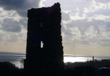
the Harbour Chart near the north-east point of the Head. DUNMORE, Dún Mór - “Great Fort”; so called from an earthen
entrenchment, still in part surviving, which crowned and defended the promontory known as the “Black Knob,” on which
stood the Coast Guard Signalling Station. The earthwork here is of the headland isolating class so frequent along the
Waterford coast, and consisting of a line, or lines, of embankment thrown across the neck of the promontory. In the
present instance only portion of a single embankment remains. Under the head of Dunmore is to be included Nymph
Hall, a portion of Dunmore cut off to form a separate townland with the foregoing fancy name. Area (with Nymph Hall),
457 acres. S.DD. (1) Inland - (a) Parkmoe (O.M.), Páirc na mBó - “Field of the Cows,” the present public park of
TP106PT “Vita S. Declani” in Bollandists, July 14th. TP107PT See Journal R. S. Antiquaries, Vol. I., 5th Series, pp. 476,
&c. TP108PT See Gaelic Journal, Vol. II., p.370. Dunmore. (b) Parkanearla (O.M.), Páirc an Iarla - “The Earl’s Field.” (c)
Gleann Marfach an Lao - “Glen of the Slaughter of the Calf,” in reference to some legend or event now forgotten. (2)
Along cliff line from north to south and east to west - (a) Faill an Chipín - “Cliff of the Broken Piece of Stick.” (b)
Laweesh (O.M.), Láimhís; meaning uncertain. (c) Cathedral Rocks (O.M.). (d) Poll Dubh - “Black Hole”; this is a chasm
on the cliff edge. (e) Counsellor’s Strand (O.M.). (f) Dunmore Strand (O.M.). (g) Carriglea (O.M.); this is locally -
“Goosey’s Rock.” (h) Ladies’ Cove (O.M.). (i) Poulnaleenta (O.M.); Poll na Líonta - “Hole of the Nets” the name does not
seem to be now known locally. (j)Badger’s Cove (O.M.). (k) Stony Cove (O.M.). (l) Shanoon (O.M.), Sean Uaimh - “Old
Cave.” (m) Black Knob (O.M.) (n) Uaimh na gColm - “Pigeons’ Cave.” (o) Oonagh (OM.), Uaimh an Eich - “The Horse’s
Cave.” FORNAGHT, Fórnacht - “Completely Bare (Hill).” This word occurs in place-names a few times only. Area,
384acres. “Fornaghty” (Down Survey Reference). S.DD. (a) Tobar Bhaile Uí Chaoimh - “Well of O’Keefe’s Homestead”;
reputed locally to possess curative properties. (b) An Ghrianóg - “The Sunny Place.” A field on N. boundary of townland.
(c) Gleann Díoráin - “Glen of the Dropping.” (d) Cúilín na Trá - “Garden of the Strand,” a synonym for Fornaght.
GRAIGARIDDY, Gráig na Roide - “Village of the Scum.” There is a large pond or water hole on which an impregnation
of iron in the soil deposits a reddish film. Area, 134 acres. S.D. “Cudds” ; presumably from cuid, “portion,” (conacre
plot). This name is applied to a field, or couple of fields, comprising a few acres. KILLAWLAN, Cill Athláin - “Awlan’s
Church.” The present is one of the few instances in which neither detailed physical examination of the locality nor
careful search for tradition was successful in bringing site of the early church to 1ightTP109PT. Area, 63 acres. S.D. Áth
an Aifrinn - “Ford of the Mass,” because the road to a chapel of the Penal Days passed through it. KILLEA, Cill Aodha -
“Aodh’s Church. Under 1203 Sweetman’s Calendar records “grant to Heverbrict of Dunmore of the church of St. Eroth,
Calech,” as well as Fornacht and Ardriedan. Area, 2 acres. KNOCKACURRIN, Cnocán Uí Churraoin - “O’Curran’s Little
Hill.” Area, 38 acres. KNOCKAVEELISH, Cnoc Mhílis - “Myles’ Hill.” We cannot unfortunately identify Myles: he must
have been a person of some note (perhaps legendary), for his name is perpetuated in the ancient designations of
Ballinlough Lake (Loch Mhílis)TP110PT and Woodstown StrandTP111PT: (Trá Mhílis). Area, 364 acres. S.DD. (a) “The
Short Head” - in contradistinction to Credan (the Long) Head. (b) An Ché Frainnceach - “The French Quay.” LICAUN,
Leacán - “Little Glen Slope (or side).” Area, 232 acres. “Leckane” (D. Survey Ref.). S.DD. (a) An Coimíneas - “The
Commonage”; an unenclosed area of 29 acres. This appears as an independent townland on the Ordnance Map. Under
encroachments of adjoining farms the commonage has been almost whittled away. (b) An Chillín - “The Little
Graveyard”; the site of an ancient burial place and church was discovered with difficulty. It will be found on Butler’s farm,
and indicated by a remarkable “bullán” or stone carved with a basinlike depression. “Bullán” is merely a corruption of
the English word bowl. LEPERSTOWN, Baile na Lobhar - “Townland of (belonging to) the Lepers”; so called because it
was portion of the endowment of the Leper Hospital of Waterford. In this townland is a considerable area of
commonage which formerly was much larger. S.D. (a) The Fairy Bush (O.M.), Leacht Sceiche an Bhóthair - “The Leacht
of the Bush of (by or in) the TP109PT “Achlenna vocatur matcr SS. Fintane, Columbi, et Lugadii,” Colgan, “Acta
Sanctorum” note, p.544. TP110PT Speed’s Map of “The Province of Munster,” London, 1610. TP111PT See
Woodstown, Kilmacomb Parish. Road.” A leacht is a pile of stones-erected on the spot where the tragic occurrence took
place - to commemorate a murder, fatal accident, or suicide. “Fairy bushes” (whitethorn) are uncommon in Waterford.
(b) Rinn Rua - “Red Headland”; a considerable sub- division of very poor land - which derives its name from the colour
of its soil. (c) Macha an tSasanaigh - “Cattle-yard of the Englishman (Protestant).” In the modern spoken language
“Sasanach” conveys the idea of “Protestant” rather than “Englishman.” Irish speakers regarded the two as synonymous,
as witness the colloquial - “English Bishop,” i.e., the Protestant Bishop, &c. (d) An Coimíneas - See under Licaun
above. The Commonage, embracing some thirty acres, is locally regarded as merely an appendage to Leperstown or
Licaun. PORTALLY, Port Fhalla - “Haven of the Parapet all.” Port is a “haven,” even in the figurative sense, e.g. “Ata na
purt uasacan.”TP112PT Area, 116 acres. “Portallege” - (Inq. Jac. I.). “Portallagh als portallog als portallug” - (Acts S. &
E.). S.DD. (along cliff line-east to west). (a) Poll a tSéine - “Hole of the Seine Net.” The pool so named is within next,
scil:- (b) Cuan Phort-Fhalla - “Portally Cove.” (c) Poll Uí Cheagadáin - “O’Ceagadan’s (Cadogan’s) Pool.” (d) Faill na
gCaorach - “Cliff of the Sheep,” down which possibly a flock, or number, of them, fell. (e) Leac na bhFear - “Flagstone of
the Men.” (f) Uaimh Dhubh - “Black Cave.” Killure Parish THE parish is coterminous with the townland of Killure, from
which it derives its name - Killure, Cill Iúir, i.e., “Church of (the) Yew tree.” Its ancient church, of which portion still
stands, was impropriate on the Knights Templar. It is pretty safe to infer from its Irish name that the later Church of the
Templars merely replaced an earlier Celtic foundation. Area, 627 acres. “Kyllure” (Visit. Eliz. E. 3, 14, T.C., Dublin). S.D.
Carraig an tSíoda - “Rock of the Silk.” Origin of the name is unknown; possibly derived from someone named Silke or
Sheedy.
Places
Services
Events